
Nixa Neighbors by Block
Public sources describe a Nixa block in layers. The county parcel service supplies the physical parcel, its identifier, situs fields, subdivision, legal description, acreage, and owner-style information. The city map adds lots, street names, city boundaries, zoning, districts, and other geography. Neither creates a household roster. A parcel owner may live elsewhere, and renters, guests, utility customers, delivery recipients, and protected voters are not a reliable public inventory of nearby people.
| Block source | What it shows near an address | Access and limit |
|---|---|---|
| Christian County GIS parcel layer | Adjacent geometry, PID, situs, subdivision, legal description, acreage, assessed totals | Public web map and REST layers; a parcel is not a list of occupants |
| Nixa Community Map | Lots, addresses, streets, city boundary, zoning, subdivisions, districts, and public layers | Public map; use its layer controls for context |
| Missouri voter route | One exact registration match or a statutory list request | Public lookup requires identity fields; no public block-browse screen was located |
| Nixa Neighborhood Watch | Local safety-program presence and watch-group count | Public participation resource, not a resident roster |
| Community and Chamber contacts | Public organization or business contacts | Useful for contact context, not proof that a person lives on the block |
For Nixa neighbors, keep every conclusion narrow. A GIS selection can identify the parcel beside an address. A deed may identify a grantor or grantee. None of those records establishes every person who lives at a property or visits it.
Map Nixa Neighbors Parcel by Parcel
The lawful adjacent-parcel method is geographic. Start at a known situs, identify the parcel, and pan outward one parcel width at a time on the same street. Christian County's public service supports map selection and, where technically available, geometry or distance queries with ordering, pagination, and statistics. Those options help define a small area. They do not turn the map into a list of households.
- Open the county map and locate the street address or an address point. Confirm the physical situs before reading owner-style or mailing fields.
- Select the target parcel and record its PID, situs street, subdivision or lot context, legal description, and deed book/page where displayed.
- Pan to each touching or nearby parcel, saving the visible parcel identifiers and street context without assuming the listed name is a current occupant.
- Use the legal description or deed reference with the Recorder if a property-history question remains. For a full named-street chain, use the Nixa Street Directory.
The Christian County GIS parcel and address service supplies the public parcel layer used for a Nixa neighbors search.
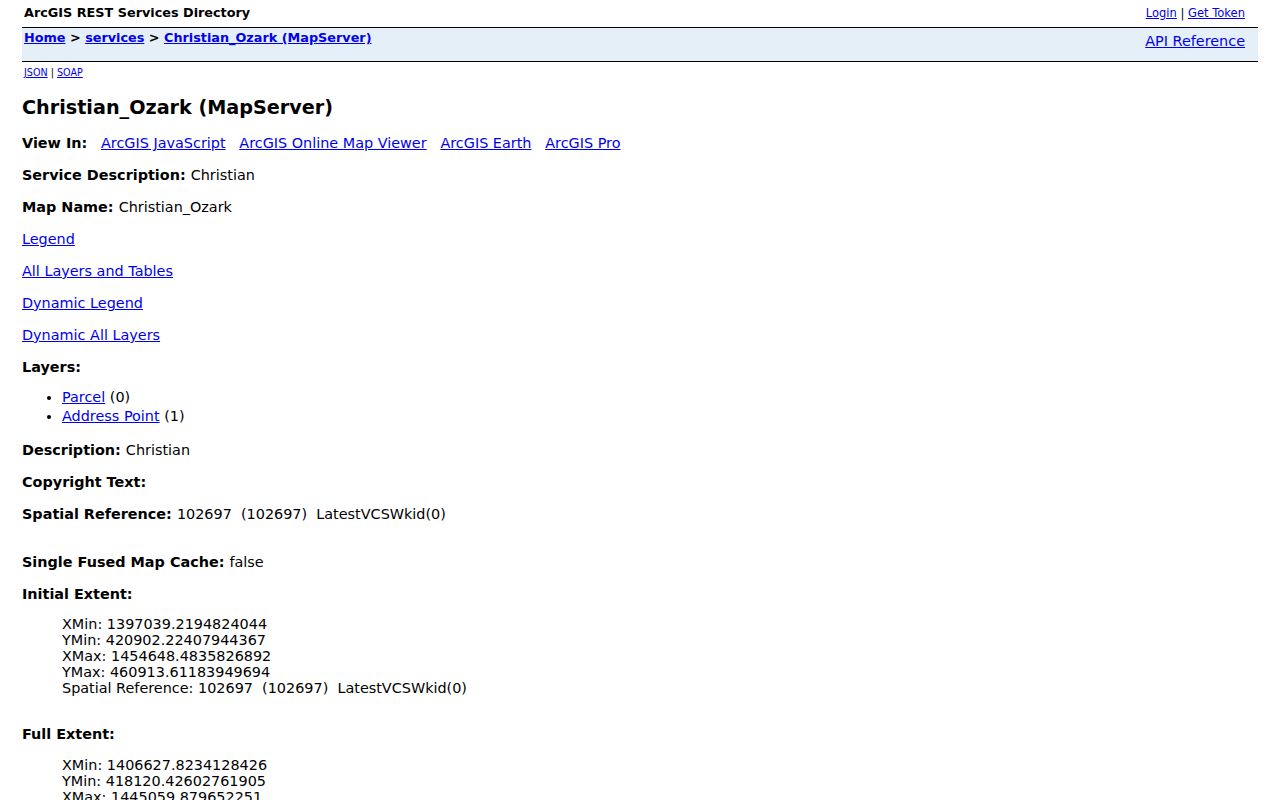
The selected feature can expose map attributes such as parcel number, address fields, deed book/page, legal description, and subdivision. It does not expose a public roster of all people connected with the parcel.
Nixa GIS Layers for Neighbors
The county service makes several location concepts visible at once. A situs address is the physical parcel location. A mailing-style address can be where tax correspondence is sent. A legal description uses a lot, block, subdivision, section, township, range, or other land wording that connects the parcel to a deed. For a block question, the situs and visible geometry establish the place; a different mailing address does not show who is present there.
| Parcel identifiers | parcel_no, PID, and related identifiers help connect map features to records. |
|---|---|
| Address fields | address1 and address2 can be mailing-style fields; sit_stnm and sit_city describe situs context. |
| Record bridge | deed_bkpg, leg_des, and subdivision fields can lead to a recorded document or plat. |
| Map caution | County cadastral-map metadata says the map is informational and not a boundary survey. |
A legal description is especially useful when a block was split, a lot was replatted, or an old street reference needs to be checked against the current parcel shape. The map reports no attachment collection and no SSN or birth-date fields in the inspected layer.
Nixa Community Map for Neighbors
The City of Nixa Community Map is the boundary and context layer for a neighborhood search. Its documented layers include city boundaries, lots and addresses, street names, council districts, zoning, subdivisions, school boundaries, sidewalks, snow routes, mosquito-fogging areas, and sinkholes. Layers are hidden by default and can be turned on with the map's crossed-out eye control. This context is useful when a street lies near a city line or crosses a subdivision boundary.
The Nixa Community Map shows the geography that surrounds a parcel result and helps place nearby Nixa neighbors in the correct city or subdivision context.
Use the city-boundary layer before treating a Nixa mailing label as proof of an incorporated Nixa location. ZIP 65714 can apply outside the city limits, so parcel and boundary layers are stronger evidence of jurisdiction than the postal label alone.
Note: The city map supplies location context, while the county parcel service is the ownership and assessment bridge for a specific lot.
Nixa Voter Records and Neighbors
Missouri voter information is not a public tool for browsing everyone on a block. The statewide lookup requires the exact registered first and last name, date of birth, last four digits of the SSN, and county. It can confirm an individual registration and election context when the inputs are correct. A failed match may reflect a spelling, birth-date, SSN, or county mismatch rather than a conclusion about a person's presence in Nixa.
RSMo 115.157 identifies specified public voter fields, including name, year of birth, address, township or ward, and precinct, subject to protections. A fee-based voter list may be available through the election authority under the statute, but the inspected sources did not establish a Nixa street-format file, a current Christian County price, or a delivery format. The state route does not disclose ballot choices, and voter-history lists have their own rules and restrictions.
Protected addresses can be closed by court order for qualifying people, and Safe at Home participants use a substitute address in new records. Ask the Christian County Clerk about a lawful statutory request instead of assuming a map result can be matched to a voter record.
Note: Voter status and parcel ownership answer different questions, and neither proves every person present at a nearby address.
Nixa Neighborhood Contacts
Community organizations give a block a public contact layer, but they are not sources for private resident names. Bentwater has a public community landing page and a resident-login boundary. Nixa Neighborhood Watch is a city crime-prevention resource. McGuffey Park Homeowners Association appears in the county organization directory, yet the inspected sources did not provide a public membership roster or joining instructions. The Chamber's public directory is a business and civic network rather than evidence of nearby residence.
| Organization | Public contact or resource | What it does not establish |
|---|---|---|
| Bentwater community | P.O. Box 2014, Nixa; board@bentwaternixa.com; public amenities and login-gated resident portal | Its public page does not provide a member roster |
| Nixa Neighborhood Watch | City crime-prevention page; the city reports 28 watch groups | A watch group is not a published list of participating households |
| McGuffey Park HOA | Named in the Christian County organizations directory | No public roster or joining details were located |
| Nixa Area Chamber | Public member and event directory; 902 W. Mt. Vernon, 417-725-1545 | Membership connects an organization or business, not a private household |
Use an association or Chamber contact to ask about public events, amenities, or an official contact route. Respect login gates and private group records.
Nixa Neighbors Official and Commercial Sources
Official and commercial neighbor tools serve different purposes. An official map preserves its source context and lets a reader see whether a field describes a parcel, a public record, or a city boundary. Commercial categories often combine brokered address history, parcel extracts, marketing data, and inferred associations. Those products may merge same-name households, retain stale information, or miss protected and closed records.
| Source category | Strength | Limit for a block question |
|---|---|---|
| County and city records | Parcel, street, boundary, deed, and custodian context can be checked | They do not establish every occupant or private contact detail |
| Community contact routes | They provide an official contact or public event layer | Membership and resident lists can be private or login-gated |
| Commercial neighbor category | May bring together several address-related data points | It is not a government record, boundary survey, or proof of identity |
For Nixa neighbors, return to the official custodian when a detail matters. The Christian County Recorder, Clerk, Assessor, City Clerk, or court controls its own records and correction process.
Nixa Blocks and Early Map Clues
Nixa's historic 1881 plat centered on Mount Vernon Road running east and west and Main Street running north and south. Older deeds, newspapers, and local references can therefore use a post-office place, rural route, landmark, abbreviated street, or historic road form instead of a current address. Preserve the wording from the original source, then compare it with a legal description, subdivision, lot, or current GIS geometry before placing it on a modern Nixa block.
That record geography matters most for family and property history. Early county series are spread among courthouse offices, State Archives microfilm, libraries, and historical organizations rather than one unified database. A nearby historic reference can be a lead, but it should not be presented as a current neighbor connection.
Nixa Neighbors Privacy Boundaries
A block map is not permission to assemble a private profile. Renters, guests, household members, protected voters, utility customers, and delivery recipients remain outside a dependable public block inventory. Missouri Safe at Home protects the physical address of qualifying survivors through a substitute address on new government and court records. Court records can also protect confidential addresses, and public voter disclosure has statutory exceptions.
Lawful personal use. Use Nixa neighbor information for personal, civic, property, or community questions within the record rules. Do not use a parcel, map, public contact, or address clue to watch, harass, threaten, intimidate, or expose any person.